New Waterfront Installation: CoastSnap
by Ryan Palmer - Director of CURB
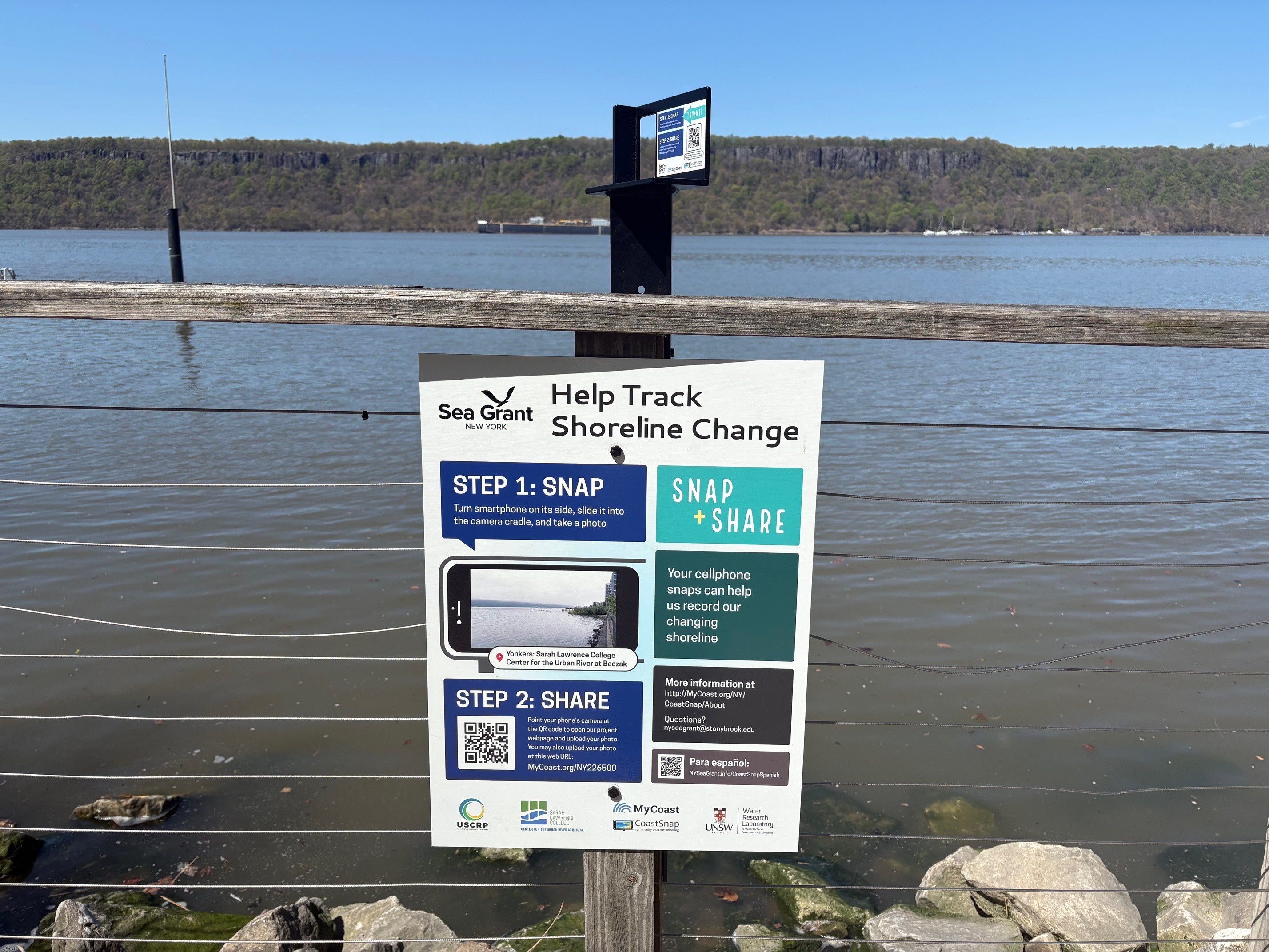
This spring CURB staff worked in partnership with New York Sea Grant and The U.S. Coastal Research Program to install a CoastSnap documenting station at the Hudson River in Habirshaw Park. The station includes signage with instructions and a fixed camera cradle stand that allows anyone to take a photo from the same location and perspective and upload it to the web.
CoastSnap is a global community science project to capture our changing coastlines. In New York, CoastSnap is managed locally as MyCoast New York. The MyCoast New York portal is used to collect and analyze photos of changing water levels, shorelines, and hazardous weather impacts across New York’s coasts. Photos are linked to real-time environmental conditions to create reports that help stakeholders understand our changing environment and make informed decisions.
Over time, CoastSnap photos will record coastal change, helping us understand why some coastlines are more dynamic or resilient than others, ultimately supporting the management of valuable coastal environments.
To see the photos collected so far and learn more see: https://mycoast.org/reports/shorepiclocation/sarah-lawrence-college-center-for-the-urban-river-at-beczak